English
Category:Other
Version:451.0
Size:11.30M
Updated:2024-08-14
Language:English
Ratings:462
Package ID:com.openglsupersense
Developer:MARIO DE QUEIROZ MONTEIRO
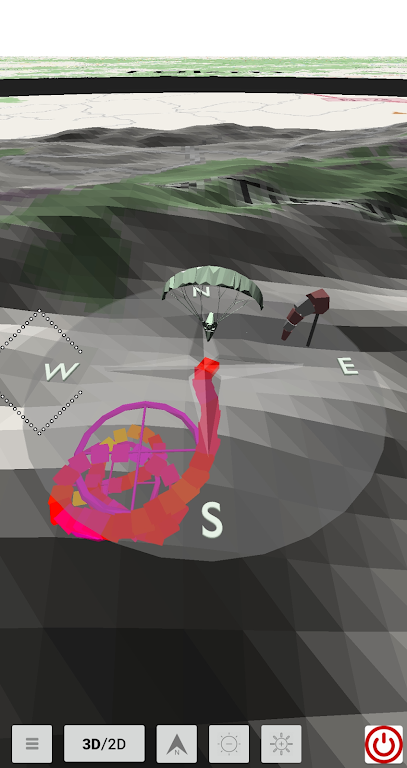
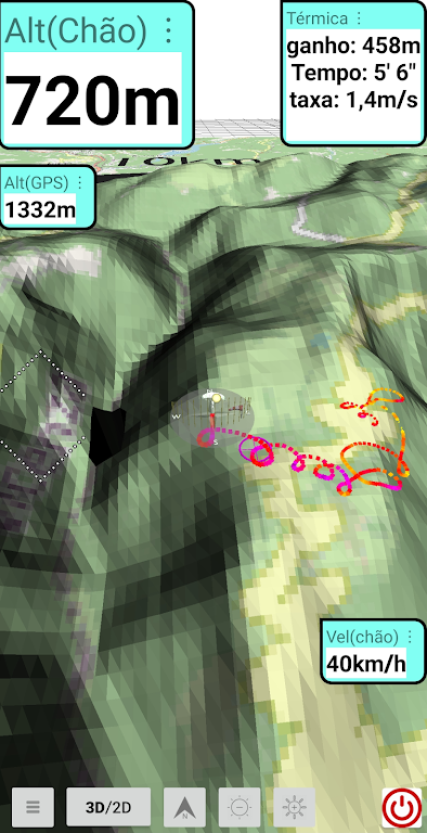
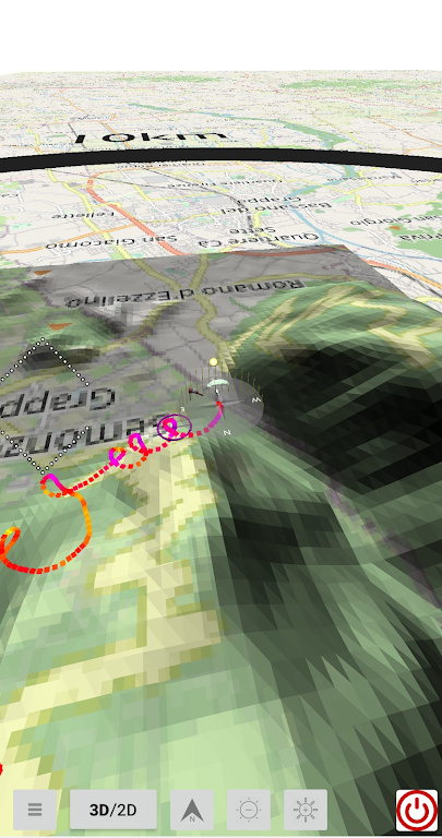
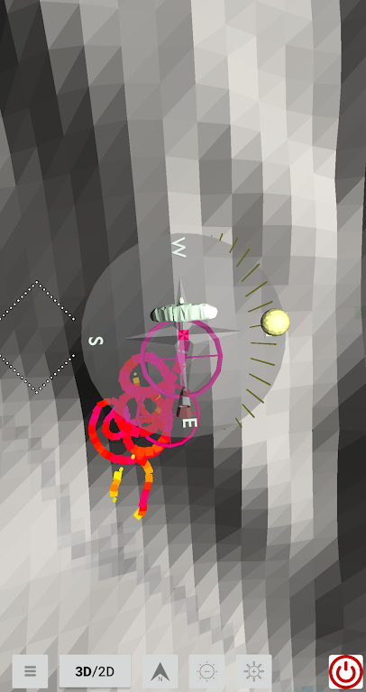
Supersense 3D Free Flight is an incredible app designed to make your flying experience even more thrilling and adventurous. With this app, pilots can easily map thermals through a 3D flight trail, allowing for enhanced navigation and exploration of the skies. You can even test the app's features by replaying existing igc files and immersing yourself in the flight experience. The app also offers intuitive infoboxes, displaying important flight information such as GPS altitude, speed over ground, and more, all easily customizable to your preferences.
⭐ Supersense 3D Free Flight: A Free flight software that supports pilots in mapping thermals through a 3D flight trail.
⭐ Intuitive Flight Information Display: The software easily and intuitively displays flight information through infoboxes, allowing pilots to customize the location and font size of the information.
⭐ Elevation Data Download: Users have the option to download elevation data from each continent, sourced from the free NASA SRTM project.
⭐ Existing IGC File Replay: Pilots can test the application by replaying an existing IGC file, allowing them to familiarize themselves with the software's features and functionality.
⭐ Start by Replay IGC File: To get a feel for the application, start by replaying an IGC file. This will allow you to understand how the software works and familiarize yourself with its features.
⭐ Customize Information Display: During the replay, drag the infoboxes to your desired location to have flight information conveniently displayed. You can also adjust the font size by double-clicking the infobox and selecting the appropriate font size from the menu.
⭐ Download Elevation Data: Take advantage of the option to download elevation data from each continent. This will enhance your mapping of thermals and make your flight experience more accurate.
With its intuitive flight information display and customizable features, users have full control over how they view and access crucial flight data. By replaying existing IGC files, Supersense 3D Free Flight can easily get started and familiarize themselves with the application. Additionally, the option to download elevation data from each continent further enhances the accuracy of mapping thermals. Make the most of your flying experience with Supersense 3D Free Flight. Download now and take your flights to new heights.

Copyright © 2025 youkelai ALL Rights Reserved
altairitsdnbhd1@gmail.com


![Text Scanner [OCR] APK](https://image.youkelai.com/upload/202502/15/9bef3QN0WotMKTD.jpg)